Epic K2 Base Camp Gondogoro La Trek Pakistan

k2 base camp trek

Here are the details of my Trek to K2 Base Camp on Baltoro Glacier and return over Gondogoro La  Pass. I didn’t climb K2 (not yet), so I can’t tell you how it feels on the Abruzi Trail or the Notorious Traverse.

Table of Contents

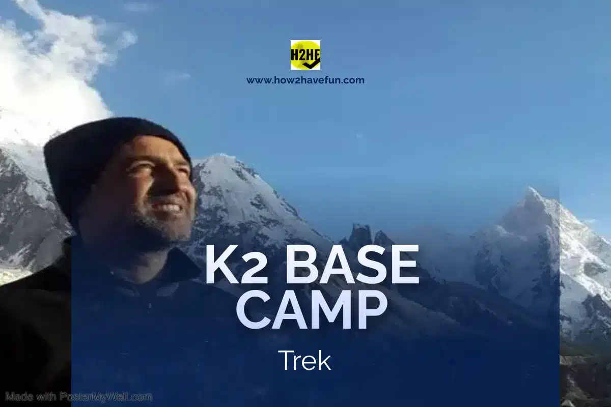
Introduction to K2 Base Camp Trek

Measured at 8611m, K2 is probably the tallest mountains in the World as studies suggest it might be 900 ft higher than mount Everest. As not enough people have been able to scale it with heavy measuring equipment to log its height correctly.

Hence, the nickname “Savage Mountain” or Chogori.

K2’s climbable side can be accessed only from Pakistan.

K2 Base Camp and Gondogoro La Trek Map

Map of K2 Base Camp Trek and Gondogoro La

Day 1 of K2 Base Camp Trek – Flight lands at Skardu International Airport Pakistan

To save time and energy on this grueling trek, it is best to fly to Skardu Airport, instead of driving there. Also, try to fly out afterwards too because you’d not have the energy to drive back. You’d be lodged in the local hotels that are reasonably clean and well stocked. You’d cannot find any trekking or hiking gear in Skardu, so bring your equipment with you.

Also, see Things to do in Skardu Pakistan

Day 2 of K2 Base Camp Trek – Drive to Askoli Village

Early the next day, jeeps drive you 4 hours from Skardu (2228m), to Askoli village (3040m)which is the staging point tent village to the hike that traverses Baltoro Glacier up to Concordia.

Driving to Askoli you pass through the ancient Buddhist rock Carvings of Shigar, the Katpana Desert and Amburik Mosque.

Then the jeeps drive alone raging Braldo River, which sometimes washes over the road. There is also the fear of lose rocks and gravel coming down from the mountains. People have died on this road.

Short of Askoli is the Khurfey village which is famous for the Western Lady that fell in love with her trekking guide who saved her from certain death when she fell inside a Glacier crevice. The German lady took the porter to her country and now funds development schemes in Khurfey. 

Every tour reaches Askoli because this is the last spot where you can get a shower, shave and fresh meal.

Askoli is a small, poverty stricken hamlet at the entrance to Baltoro and Biafo Glaciers and is surrounded by towering mountains. It has its own rudimentary museum. It isn’t freezing here in June, which is comforting. We rested the night at Askoli and set off on foot early next day in the Easterly direction.

Route Map Islamabad to Skardu takes 14 hours now

Day 3 of K2 Base Camp Askoli to Jola Camp

We hiked for 7 hours (21 Kms) to Jola camp site (local name is sam saam ‘sweet water’). We crossed the mouth of Biafo Glacier on the way.

PRO TIP 1

There is hardly any spring or stream along the way so carry at least 3 liters of water whenever you leave a camp site

Jola was a tent village along a river stream, where there is running water available but not hot water. It gets cold at Jola at night.

Biafo Glacier

Biafo has receded 12 kms from the mouth in a short period of time due to global warming.

We trekked up to Jola camp (3218m) which was less stony and had an easy incline. We had to hike another extra hour to the river just to find a good crossing spot towards the site. Jola was across the river in our plain sight all along. We crossed a rickety wooden bridge to reach the Camp.

  • I took cold bath there Au Naturale, but I don’t think it was a good idea because some of our mates started vomiting due to the cold.

At Jola, the park rangers told us that there is quite some wildlife there, which you can observe with a binocular:-

  • Markhor
  • Ladakh Urial
  • Snow leopards

I didn’t know that Ladakh Urial is not a mountain sheep instead it roams the plains and hops across rivers on signs of trouble.

Latok Peak on Pakistan China Border

The Jola site is at the mouth of the ravine that leads to Latok Peak.  Near Latok Peak is a mountain pass at the very end that crosses into China.

Western Adventurer Milton

The park ranger told me that a western adventurer named Milton somebody went across into China through Jola route and came back into Pakistan on skis, traversing various passes along the route. He runs his own travel company from UK for this destination.

Day 4 K2 Base Camp Trek Jola to Paiju

On Day 4, we set off on a 9 hour trek (20 km) to Paiju (pronounced pa’yo) @ 3383m. Most of the terrain was level but it did get pretty hot in the afternoon Sun. Here too water is scarce except for a water fall at the start.

Paiyo means salt in Balti language and here the snow doesn’t solidify in the salty sand.

As this trek was hot, tiring and long, I had to cover my head all the way with Arab Scarf (Shemagh / Keffiyeh).

The last one hour leading towards Paiyo was difficult because the goat trail was sandy and had rapid ascend and descents, with a steep drop into the river on the side.

Paiyo camp site has running water but in limited supply. I had a wet towel rub here because I couldn’t sleep with sweaty underarms. 

We rested the next day here just to see who could make the journey ahead. We had a wonderful lamb stew and lots of songs and dances here.  One of our unassuming porter Ibrahim came alive in his love for music. He suddenly transformed into a rock star, smiling and enjoying the whole time. We all nursed our injuries; boils, cuts bruises etc. here. Paiyo is not the prettiest of sites. From the next day I wore proper hiking shoes instead of my ripped running shoes.

Paiju to Muztagh Trango Towers

Rock climbers leave the Boltoro here and hike a further 7 hours into the Muztagh-Trango Gorge to reach Trango Towers Base Camp at 4900m.

Solid Granite face of Trango towers is an alpine climbers dream come true. Great Trango is 4396 ft of vertical Granite, more than any climbing face in the world. 

Alex Honnold, El Capitan’s got nothing on this – you listening?

k 2 base campl

Day 5 K2 Base Camp Trek Paiyo to Khobutze

This day involved a 6 hours hike (14 Km) to Khoburtze (bitter plant) site @3566m. Nothing significant happens here because I was so exhausted from the miles and miles of nothingness.

The landscapes are like I have never seeen before in my life. Tall mountains line both sides. The terrain had gotten difficult because of the flat stones, undulating terrain and limited water supply en-route.

We were walking on Boltoro glacier now, hence the flat stones. At night I could hear the glacier moan and groan and large rocks breaking free and falling into the lake below. The sounds are quite scary and one never gets used to. 

Khobutze site is a quite far from civilization and has limited open air washrooms and running water. At this stage the food supplies are also dwindled so the food isn’t that nourishing and you rely on your energy bars.

Day 6 K2 Base Camp Trek Khobutze to Urdukas

The Urdukas (split rock) @ 4130m hike was also tough and lengthy of about 6 hours (14 Km). The campsite itself is near an old military supplies dumping site on a level ground on the right wall the runs along Baltoro Glacier.

The name “split rock” comes from a massive boulder that split from the mountain in 2010, without warning, and fell on top of the unsuspecting military porters down below. There are many more hill like boulders ready to split further hanging over head the camp site.

The site had solar lights and was well maintained. Water was limited though.  The toilets are far away so make sure u attend call of nature during sunlight

Here we had our first well prepared Kashmiri Tea with goat milk from the local pastures. I even climbed up along this mountain to get a better view of the massive mountains on the other side. There are large valleys in between the peaks that very few people venture to.These streets are smaller glaciers joining up with Baltoro.

  • A beautiful water fall lies just above the camp
  • A monument to deceased high altitude climbers.

Here on top of the world is one of my fondest memories ever.

From the hill top pasture, I could see the mighty Baltoro curving to the right and dark clouds very close to my position.

k2 base camp

Day 7 K2 Base Camp Trek Urdukas to Goro 2

This trek to Goro 2 camp site at 4250m takes 9 hours (18km) and seems never ending from the accumulated exhaustion. We skipped Goro I site to save time, which seemed a good idea a first but not when I found my legs sore from the extra hike.

The glacier trek was a little tough as there is a serious chance of wandering in the wrong direction. After a while I realized that instead of waiting for a porter to show us the way, we should follow the poop trail of the horses and the mules’.

“Goro” means broken rock pieces (from the glacier grazing against rocks while sliding ahead). Goro I and II both are similar sites right on top of the Baltoro Glacier.

At Goro 2, they have tent toilets only and no running water. No vegetation can been seen here for miles and just rock and gravel.

Some places along the route, good Samaritans placed stones on top of rocks to show us the way but that can be misleading as the glacier shifts every year and the old track can become obsolete. 

This I learned the hard way and had to climb a mountain to find the way. Someone had placed rocks to indicate the way forward but that was an old route that had long been blocked by the shifting Glacier. The actual path was simple and straight forward.

  • At an hours hike from Goro 2 site is a beautiful pasture with a lake. We couldn’t go there as the group wasn’t interested. 

This goes to show that the real beauty is not on the beaten path.

Day 8 Goro 2 to Concordia Trek

This was another 6 hours of trek (14 Km) to reached Concordia @ 4575m.  Concordia is the camp site which leads to all the great 8000m peaks in the area.

There was a mini desert on the way. This trek was difficult because of altitude effects. I had to take deep breaths every five steps. Some people developed headaches too.  Then the route is not well defined and I got lost twice.

Lots of trekkers had already settled down when we reached the Concordia Camp Site. 

Mitre Peak

Mitre peak @6010m was towards our south. A few years back one western couple tried to scale the peak and died on the way back.

Concordia is a well established Camp site with running water and tent washrooms.

The only problem is the overcrowded tent village and trash from previous expeditions that no one carries back.

Day 9 Rest Day at Concordia (or Trek to K2 Base Camp)

The fitter among the group skip the rest day and hike all the way to K2 Base Camp that is about 10 hours (20 km) from Concordia.

Mostly people rest and enjoy the scenery at Concordia.

At this Camp site, because there are glaciers opening on both sides, it get very cold here below freezing at night.

Lots of people develop altitude sickness due to fatigue and chill.

At night the temperature drops rapidly to -25 Deg Celsius and everything freezes over.

My sleeping bag was very good thankfully. I couldn’t go out to relieve myself even at night. No lights here so head lamps are a must. Don’t forget to bring a solar powered lamp for your tent.

Most of the batteries drain automatically at night due to cold, so keep backups.

Concordia requires:-

  1. Better Garbage Removal or Control
  2. Better Sanitation
  3. Flowing Water
  4. Boundary fence to make it presentable.
  5. Solar Lights 
  6. Backup generators
  7. Better Ration supply

Although the gorgeous mountains overshadow everything else.

Things to enjoy at Concordia

Views of:-

  1. K2 Godwin Austin
  2. Gasherbrum I-IV
  3. Unnamed 7000m peaks
  4. Boltoro Glacier
  5. Broad Peak
  6. Siachen Glacier Saddle
  7. Vigne Glacier

K2 Godwin Austin Peak from Concordia

I got my first glimpse of K-2 the giant exactly towards north of where I was. I couldn’t make out.

  • Chicken neck
  • Black pyramid
  • Traverse

K2s dangerous ridges and sheer falls are clearly visible even at a lower altitude. The K2 Base Camp cannot be seen from Concordia.

Winds blowing over the tip of the killer mountain can be seen from hundreds of miles away. These howling winds kick-up snow and clouds with them and are known to terrify climbers.

K2 Camp 3

At night time, climbers were still at camp 3 of K2 as I could see their lamps. Later on one team summit K-2, including a British-American Lady.

A porter told me the story of two local hi-altitude porters who were left stranded on the traverse on the way back from the summit by their Nepali Sherpa, because he had to save his Japanese Patrons.

Then the story of a western climber in 2021  forcing Ali Sadpara , the celebrated Sherpa of Pakistan, to attempt K2 summit in bad weather forecast. Three climbers were later found frozen to death.

This same abandoning story was repeated again in 2023 by another Western Lady on the traverse with another Pakistani Sherpa.

Why is K2 called the Savage Mountain?

As K-2 is 500 miles further North as compared to Mt Everest, hence, the high mortality ratio 1:4 (nearly 77 deaths; 300 successful summits).

There is no margin of error with Mother Nature high up there.

Broad Peak from Concordia

Looking North-Eastwards from Concordia was Broad Peak (8051m), with its flatter top.

I saw climbers (head lamps) attempting summit during the night. The clouds blowing over these peaks seemed so magical

Gasherbrum IV Peak from Concordia

Gasherbrum IV (7925m) was even more North East. Its sharp tip was glowing in golden light.


Unnamed 7000m peaks near Concordia

There are several dozen 7000 m peaks around Concordia that have never been climbed or named either. While I was there, I met two British climbers who abandoned the quest to summit a local peak as they said that the snow gradient increased from 75 to 90 Degrees suddenly and they didn’t have rope training.

Then there is the story of an American Surgeon that died while climbing an unknown peak here.


k 2 base camp

Boltoro Glacier at Concordia

Boltoro constantly groans at night with rock falls and cracking noises. It can be quite disturbing.

Gasherbrum I & II from Concordia

On gully from the Concordia leads to k-2, the other to Gasherbrum I, II etc. and Indian Line of control and the third leads to Vigne glacier, where we planned to go after the rest day.

Siachen Glacier Saddle Post from Concordia

Pakistan army’s saddle post is towards East of Concordia. These soldiers are brave people to survive in this cruel environment, year around.

It is a few more days trek to reach the precariously placed Saddle post of Siachen Glacier that marks Pakistan’s Line of Control with India on Kashmir.

Day 10 Concordia to Ali Camp Vigne Glacier

On the rest day, we had decided that it is more value for money to turn South towards Moon hill camp, cross over at Gondogoro La and complete the loop to Skardu Via Hushe Valley.

Ali Camp or Moonlight Camp is 12Km and 6 hours away

Many think otherwise and like to reach K2 Base Camp and Climb till Camp 1 of K2.

The interesting thing was that the girls in our squad reluctantly agreed to join us on a potentially treacherous climb.

Vigne Glacier South of Concordia

The Vigne Glacier is solid blue ice, with not even the dark earth covering it. The glare from its surface is blinding. 

River like streams that are hundreds of feet deep meander through  the length of the glacier which is pockmarked with hazardous crevices. 

We reached Moon light (Ali Camp at 4965m) by Sunset and quickly geared up for the Dawn time climb next day.

We had a quick dinner and slept with full gear and packed carry-on

Day 11 Vigne Glacier to Gondogoro La Pass 

Early morning next day before dawn we set off on the most grueling climb i have ever attempted in my life, to the summit of Gondogoro La Pass (height 5585m).

Here crampons are very helpful, but simple metal stud grippers can also work fine. 

At one place while climbing, i wondered what would happen if I slipped and fell on top of the climber that was directly below me.

When I finally reached the summit and turned around, my near death exhaustion vanished!

The View of 8000’er Peaks lined up before me in an array in the golden Sun light was Awe inspiring.

Gondogoro La to Khuispang Camp Site (4600m)

Our guide told us to hook up the carabiners and start repelling down from the other side on fixed ropes immediately because there is a grave danger of falling rock.

Ali Camp to Khuispang is 12 hours and 9 Kms

I must admit this was the first time I was scared out of my wits from the sheer height and depth of what I was seeing. 

My eyes had never seen so much as this angle, so high in the air and then nothing ahead of me for hundreds of feet below.

Hanging on to the repelling rope like my life depends on it, we all managed to get firm footing and then the never ending 14 hours hike to Khuispang Camp Site

The foot holds were frozen solid, the incline was never ending and I had no energy left to force myself.

People have died on this section due to falling rock. I was lucky just to receive a small stone shower. 

I made the fatal mistake of leaving the marked track and instead climb down into the gorge to end the tiring incline. When I got half way down off the mountain, I realized there is further  300 meters cliff at the end of this one. I was lucky to turn back immediately and came up completely drained.

One couple climbed all the way down into the gorge and were the last ones to reach Khuspang Camp, looking dazed and zombie-like. There are dangerous crevices in the gorge as well.

I was so exhausted that I couldn’t free my foot that had gotten stuck in quick sand. 

Khuspang Camp site has very little facilities, but has a narrow stream of water running by it.

You’d be so tired when you reach there that a bed made of rocks would be enough too.

Laila Peak at 6069 m at Khuispang 

In the evening a deafening sound struck the camp and when I came out, I saw a huge avalanche hurtling down from Laila Peak, which was a good distance away on the other end of the Gorge.

Laila Peak is pointed like a rocket with a jagged tip

Day 12 Khuispang to Saicho Camp (3350m) Trek

Leaving Khuispang early in the morning, we immediately climbed on top of the tail of Gondogoro Glacier on an 8 hours (13 Km) hike to Saicho Camp.

Gondogoro La Glacier

Dangerous thing about hiking across glaciers besides the hidden crevaces is the ever changing routes and landscape. You never know whether you are headed in the right direction.

The only compass we had was to find the left turn in glacier path and follow that while walking on-the ridge line. We did exactly that till there was no track to walk on.

Head of the glacier was on our right all along,while we turned left.

Glacial Lake Outburst Flood (GLOF) is a usual occurrence in these heights and it is quite pronounced in less traveled parts of Gilgit Baltistan of Pakistan. The only evidence you see is that the track that was just there for several decades suddenly vanishes and there is a deep and dangerous gorge there to replace it – with no way to go around it.

As soon as we turned the corner, a whiff of freshly scented high altitude flowers greeted us. My pumped blood pressure added to the sensation of pure ecstasy. 

The mountain rivulets swell up in Summers and can become a hazard if not navigated carefully.

I had to wade barefooted through knee deep in raging water.

k 2 base camp

Day 13 Saicho to Hushe Valley

We skipped the planned stay at Saicho and moved directly 5 hours more to Hushe village in the same valley.

Hike is 5 hours (9 km)

Hushe Valley

Hushe village is a rustic but beautiful village in end of a lush green valley and well settled by people.

  1. The village had nice hotels there as well. They charge 10000 per night for double occupancy in clean rooms.
  2. People there are very friendly and welcoming.
  3. We had French fries and tea here.
  4. A local stone merchant sold me a beautiful uncut quartz stone he had gotten from a local mine. He had other precious stones from the local mines as well.

Day 14 Hushe Valley to Skardu through Ganche

Our guide had arranged mammoth Muscle jeeps (Toyota Land cruiser hot rods with 4300 cc engines) that took us to Skardu through Ganche (snow area) and Khaplu. I drove the jeep around a bit. Absolutely delightful experience!

I loved the green paradises the Baltis had developed round perennial streams from the mountains. I wish I had one like that too.

Day 15 Skardu to Islamabad

Exhausted, everyone wanted to leave for Islamabad immediately so, we booked a flight back on the first available plane.

It is better to get an open ticket for the return journey so that you can book a flight with ease.

Driving back from Skardu would be at least 15 hours of night travel on a bus or a rented car, and that is too much after a near death exhausting experience.

Conclusion

K2 Base Camp and Gondogoro la trek is for adventure enthusiasts who can handle sustained physical and mental strain, besides fear of heights and long bouts of low energy diet. Personally, this hike will be among the top five memorable events of my life, besides skydiving and some other shady ones.

So, if you decide to join the elite league of K2 Base Campers in Pakistan, then call me to arrange it for you +923005111523 (other tours)

Essential Equipment for K2 base camp Gondogoro la Trek

This is my list of essential food and equipment according to my experience there.

Essential Snacks

I did take energy bars with me but dates, almond, Sundip/Tang, ORS did the job for me. 

Rucksack Equipment for K2 Base Camp

  • Helmet (for Gondogoro La)
  • Carabiners (Screw On)
  • Harnesses (good quality)
  • Sun Cap
  • Arab Cloth (Keffeyeh)
  • Wooly Cap
  • Sun Glasses (400 UV protection)
  • Head Lamp (extra batteries)
  • Sun Screen
  • Lip Balm
  • Balaclava
  • Fleece jacket
  • Thermals (two pairs)
  • Full Sleeve shirts (three)
  • Boxer shorts (three)
  • ¾ Shorts (one)
  • Gloves (hi altitude and hunting both)
  • Casual lowers (one)
  • Slippers (tough ones)
  • Woolen socks (three pairs)
  • Hiking Boots (Rugged Tough and fit, tested)
  • Tough running shoes (one pair)
  • Altitude watch (to keep track of height & temperature)
  • Cell phone with selfie cam and power bank (at least three charges)
  • Two pairs of water proof hiking trousers
  • Rain coat
  • Parka (with some cold protection)
  • Food (Dates & dry fruit one kilogram each), some energy bars
  • Six packets of tang or Sundip juice powder
  • Aqua tabs (10)
  • Brufen (two dozen)
  • Motillium (dozen)
  • Diamox (AZM) six
  • Anti-Giddiness medicine (forgot the name)
  • Flagyl
  • Two dozen ORS

Back Pack items for K2 Base Camp

  • Water Bladder (3 liters min)
  • Plastic water bottle (500ml for nature’s call and drinking too)
  • Camera, extra batteries, torch, lighter, Swiss knife
  • Rain coat
  • Sticks two (good quality flexible)
  • Extra woolen socks
  • Glasses with UV protection

NOTE

The allowable weight is 12.5 kgs per person. Each extra kg would be charged @ Rs 600 per kg for the round trip. Ideal weight for the Ruck sack is 18 kgs and back pack 7 kg max.

K2 Base Camp Trek tour Cost / Price

The complete tour costs

  • Rs 500,000 for Pakistanis
  • $ 3000 for foreigners (I know its unfair but serves your right for colonizing us)

K2 Base Camp Trek itinerary

This tour  includes:-

  • Airport pickup from Skardu (Inbound and outbound flight charges not included)
  • Skardu-Concordia-K-2 Base Camp / Gondogoro La – round trip Skardu
  • Drop at Skardu Airport
  • The K2 Base camp / Gondogoro La trek time is 15 days standard package.

K2 Base Camp Trek Dangers

There is no danger of your equipment getting stolen or you getting robbed or raped, but there is the danger of you getting sick deep inside the ravines where there is no health care facility and you have to be airlifted by a $10,000 helicopter sortie.

Or you can hire a $100 mule for the ride back.

K2 Base Camp Trek Independently without Guide

Now, this is a tricky question.

Technically you can hike all the way to Concordia and maybe K2 Base Camp and back if you read my post carefully.

Even if you do get lost then you can wait for the next traveler coming through the same route during tourist season to guide you.

But crossing over Gondogoro La would be difficult without hiring a guide to help you find the right place to climb and descend. 

Also, if you are a foreigner,the overzealous local administration will send with you a burly gunman to keep you safe from whatever is in their limited imagination. This guard will become more of a liability than a help, so better get a local professional guide. And they will stop you unnecessarily in the local checkpoints for which you need an organised tour guide.

See,

Shimshal Pass and Mingliksar Peak Trek

Churko peak hike

Mussa ka Mussala Hike

Miran Jani Hike

Doonga gali pipeline hike.

Similar Posts

14 Comments

  1. Tipu Sultan says:

    A great account of a trek that should be on every adventurer’s bucket list.. Yes, it has its perils.. But you could never have second thoughts of it being more than worth it. Next time.. Lots of nice pictures too.. Good stuff, WIK! (Y) 🙂

  2. Saqib imtiaz says:

    Can’t wait more to pack my bags for this beautiful and adventerous journey .. Quite moving and inspirational … lovely pics and surroundings !!

    1. You must go saqib. Its a must for an adventurer like you.

  3. Zabardast zabardast n zabardast!

  4. Faisal shah says:

    The narration of the trip is very nice, i experienced it in 2009, the most amazing photo of my trip I shot was K-2 in the moonlight..

  5. Sir great job done and very help up information for others to follow.

  6. Imagine what travellers went through .
    Marco Polo, Ibne Batuta, tracked these mountains .

  7. A jeep went down and porters got killed and falling boulders and cliffs and lost zombies……
    Not the adventure I want….I would have fries at the hotel though!!
    But I can understand the thrill…

  8. Dr Ghazala Inam ul haq says:

    Very well written

  9. Humaira Ashraf Hadi says:

    Wow just wow!!! Beautiful photos, some good adventurous fun.

  10. Awesome
    I am convinced to go there next year. Well done

    1. I will join u from here ina
      I am getting the equipment ready

Leave a Reply

Your email address will not be published. Required fields are marked *