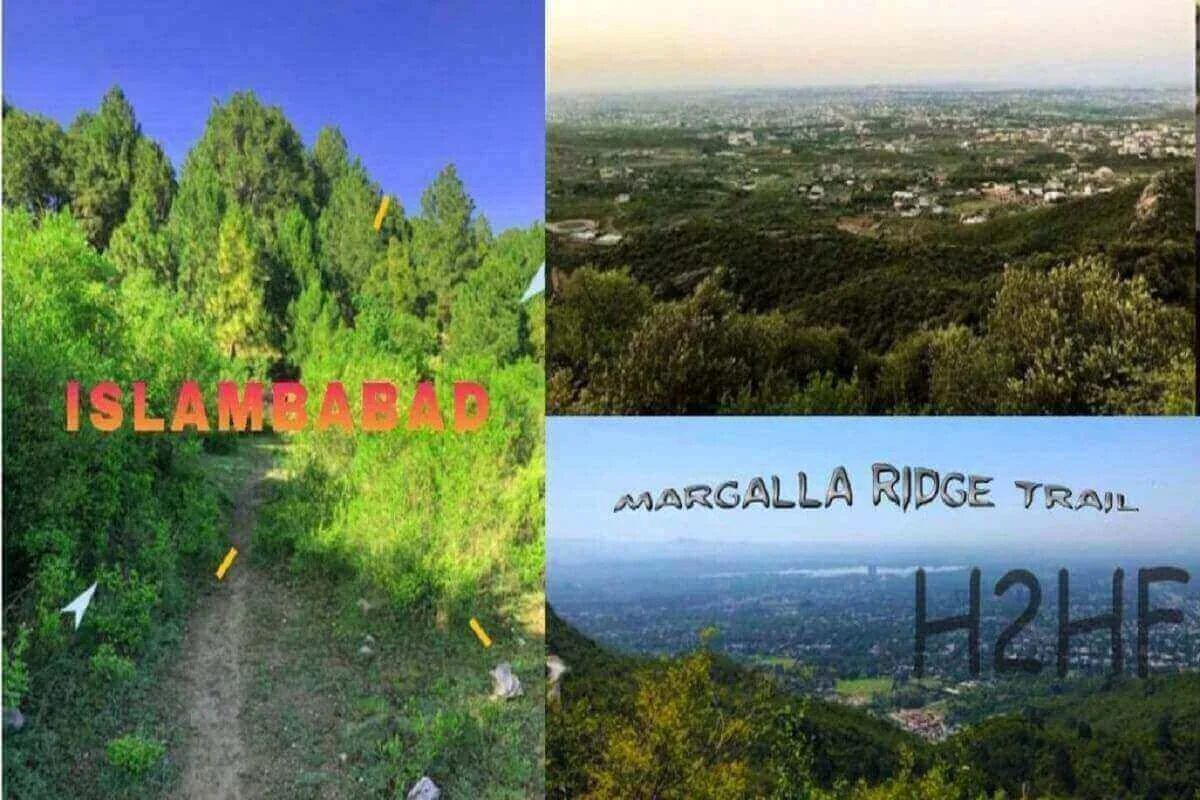
So I did the Margalla Ridge trail this weekend, and boy was it enjoyable.
First, let me go over the essential information on Margalla Ridge trail hike so that you get the rough picture upfront.
Margalla Ridge Trail staring point – Laosar Bauli, above Shah Allah Ditta caves, from where the dirt road starts and there is a village there.
Margalla Ridge trail ending point– The ending point is at Tret village, Murree, but it is a better idea to just do Shah Allah Ditta to Talhar village in the first phase.
.jpeg)
Margalla Ridge Trail total time – Laosar Bauli to Talhar is 4 hours if you follow the Margalla ridge line religiously. If you go down the Margalla Mountain on the side opposite to Islamabad and start walking along the dirt / metal roads towards Talhar, it would take you at least 6 hours.
Difficulty level – Laosar to Talhar is moderately difficult just because you have to sometimes drop down into meadows and then climb up into rock cliffs. It is tough on the knees and ankles. Women and men can both do it, but maybe not in 4 hours.
.jpeg)
Danger – The track has several areas with thick vegetation and not a soul in sight. If anyone would want to mug you there, it would be very convenient. But I never felt threatened. However, one hunting knife should be kept with you at all times, just in case.
Best time to hike or trek -The best time would be Tee off just after dawn, before the blazing sun rises above you, so that you don’t lose that much liquids.
.jpeg)
Essential Equipment – You must have proper hiking boots, as there is no clear hiking track, just a few goat trails. So, twisting your ankle is a possibility. Then you need a white cloth to cover your head and shoulders, a walking stick taller than you, water bladder with at least 3 liters ORS dissolved water, dates, wet wipes and portable camera. Don’t let your total weight grow beyond 3 kilograms; otherwise, it would be too tough on your back. Hiking trousers keep the shrubs and prickly thorns at bay. Full sleeves shirt of a light color, preferably cotton, will keep the heat out and will prevent sunburn of your arms.
.jpeg)
Margalla Ridge hike Route milestones – Village at Laosar Bauli, Shah Allah Ditta caves (do take time to visit them) Margalla hill – abandoned villas, shepherds’ cabin in the wooded knoll, the grazing meadow, climb to rocky peak, level at the watering hole and climb down to the dirt road going towards kaintla mosque, climb the peak after Kaintla mosque and follow the ridge to Sindhuri village and Kot jandan, after jandan, climb again to the peak and reach the ancient mediation spot with the ablution pond and caves, from the caves jump into the thick forest and keep walking straight till you see Talhar down below, then descend.
Return to Islamabad -Hire a Suzuki at Talhar to drive you to Islamabad and then get careem to go to your home. The Suzuki will charge Rs 50.
Just don’t forget to keep Islamabad towards your right side, at all times; this way you’d never get lost. I could see E-11, E-9, 7th road during my hike.
.jpeg)
Food, water and washrooms – none during the hike, so take sufficient light weight stuff with you.
Another bright idea would be to have sehri or aftari at the Laosar Bauli at Shah Allah Ditta caves, with an excellent view of Islamabad from high above. Lots of Gora people venture to Shah Allah Ditta and Talhar to enjoy the serenity and views.
It is possible to take a mountain bike to the Margalla ridge hike, but by someone that is reasonable good at it.
.jpeg)
There are quite a few monkeys at the Margalla peaks and some mountain cats or leopards, so don’t ventures too much off the trail.
There is a chance of getting lost, as people prefer to do the road walk instead of the proper Margalla ridge hike; for that, when in doubt, climb up! Not down.
There are plenty of excellent places to camp and chill, right beside the rain water fed ponds and forests. Just find a place where the smell of spring flowers and vegetation greets you. There are various trees with small bright flowers or orange-red and blue-purple colors that I never see down in the plains. They are exceptionally beautiful in a green backdrop.
.jpeg)
You can also view Khanpur dam, Rawal dam ( if you haven’t, do that ASAP) from one spot on Margalla trail hike, it is that high.
Illegal logging of trees is rampant in Margalla Mountains that has destroyed a significant portion of the hike’s beauty. This is because we are more concerned about making money than actually making a life for ourselves and our kids. I hope the illegal tree cutting stops.
.jpeg)
In the early morning, the sun is mild, the breeze cool, the people nowhere to be seen and the earth peaceful. It’s the best time to think, appreciate and enjoy.
The best portion of Margalla ridge hike is the thick pine jungle with the Shepard’s hut, the olive thicket with the watering pond and high cliff over Margalla streams.
.jpeg)
With this COVID-19 craze, I am astonished why this Margalla ridge trail is not jam packed with people. I don’t know what they do with their spare time — if not enjoy Mother Nature. I would highly recommend this trail for anyone that is reasonably interested in hiking.
Although Margalla hills are all interconnected in one chain, there are several individual mountains as well in this series. These mountains, like the one behind E-8 are tall and have only one way to go in and out from the rest.
.jpeg)
Some historical trivia for you all; Margalla’s original name is Markalay (Reference Aurangzeb’s tablet on old GT road) and Shah Allah Ditta is actual “Shauldita” (Ref. Major Laurence’s diaries).
This is phase-1 of Margalla ridge hike from Shah Allah Ditta to Talhar of 4 hours. The second phase is Monal Restaurant at Damn e Koh to Trek Murree, which I am told is about 10 hours.
Let do that next time. Another hike not to miss Hazir Pir Hike.
Post Script.
Margalla has a riding club and a gun shooting club as well.
.jpeg)
Encouraged by above narrative proceeded from the mosque where road to kainthla bifurcates from main road to kot jandan.Its a saddle between two ridges.Climbed the mountain to the right to the top of peak with pine forest,After a short while pines ended and descended to a saddle between two ridges with olive forest.Climbed left bare ridge with grass only and isolated small trees.At top found flat meadow like area with abandoned stone huts without roofs.Went through along next ridge on left with another small ridge on right,Two ridges met at top with a pond about 40×40 feet with dirty water,Crossed to ridge on right. Followed trail through thick bushes finally giving way to stony ridges with a precarious goat track hugging the walls.Quite scary.Eventually this track leading into dense forest and bushes and getting lost.No way forward.up or down and time being 5.15 pm it was almost dark.I was lost in the forest.Panic set in.How I made it back on the precarious track in the dark with only mobile phone light is a miracle.Lost the track seven times and tripped twice but miraculously made it back to the mosque at 8.45pm.Please be carefull.There is no ridge trail.Its all a myth.
Thanks for the insight and enjoyable narrative. I think you were probably very close to Talhar village below you on the left but couldn’t see because of the sunset. The margalla track from Lohsar bauli to talhar is about 5 hours for a fit person so you have to leave early to get there before sunset, or else you miss the smoke rising from Talhar village. Do it again, stay towards left of the ridge, and you’ll get to talhar.
I have done this ridge more than 10 times. I mostly agree to your content as it may be helpful to the occasional hikers and those who are only interested in doing some portions of the ridge. However I do not agree to you on certain issues. First of all the trail starts from Giri a village next to Khurram Paracha. On the western side of the Shah Allah Ditta village across the hills and directly leads to Kainthala. One branch of the trail descends to Shah Allah Ditta via Bun Faqiran Stupa. The losar baoli trail starting from Shah Allah Ditta is a subsequent inlet in the trail. Secondly the potential hikers need to be made aware that the track is missing from a lot of portions and they should be ready for non track hiking on the bare ridges and dense bushes. At many occasions Islamabad gets out of sight and one has to navigate on his her own good judgement. Hence the flat time of 4 hours upto Talhar can never be maintained by anyone and people should expect much more than that. The foreigners who do this upto Shah Allah Ditta are always accompanied by a well acquainted Margalla Hill guide who leads them the way.
Thanks for adding to the information.